Short answer: YES, Ca Mau has a coast
Ca Mau boasts over 254km of coastline — but it's characterized by alluvial mudflats and mangrove forests, completely different from the white sandy beaches of Da Nang or Phu Quoc. This unique difference is precisely what makes Ca Mau so special and unlike any other place in Vietnam.
What Seas Border Ca Mau? Vietnam's Most Unique Geography
Ca Mau is the only province in Vietnam that borders two sea regions: the East Sea (part of the Pacific Ocean) to the east, and the Gulf of Thailand to the west. These two seas have different water colors, different ecosystems, and even different wave directions.
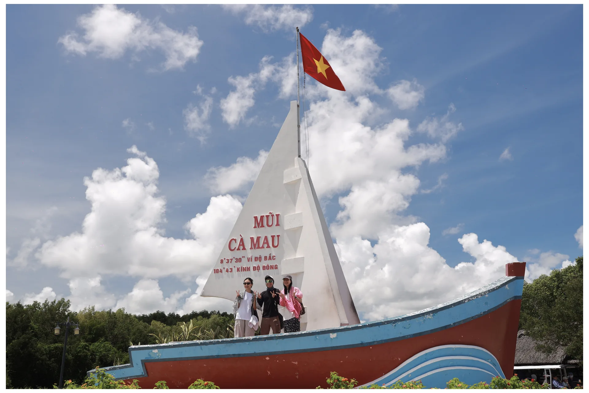
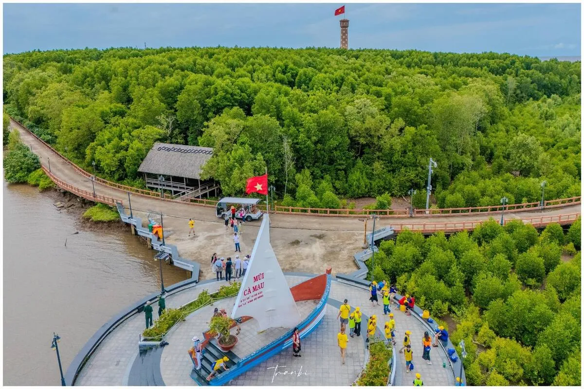
This creates a unique vantage point at Ca Mau Cape — where you can stand at the southernmost landmark and witness the convergence of these two seas. This phenomenon is not found in any other province in Vietnam.
3 Prominent Coastal Areas of Ca Mau
Ca Mau Cape Alluvial Mudflats
The land is "growing" into the sea by approximately 50–100m each year. This is one of the few places in the world where the land is still naturally expanding. The mudflats are covered with mangroves, clams, and mud snails.
Khai Long Beach
Located in Ngoc Hien district, Khai Long Beach features one of Ca Mau's rare sandy stretches. While not fine white sand, it's a popular spot for swimming and relaxation among locals.
Coastal Mangrove Forests
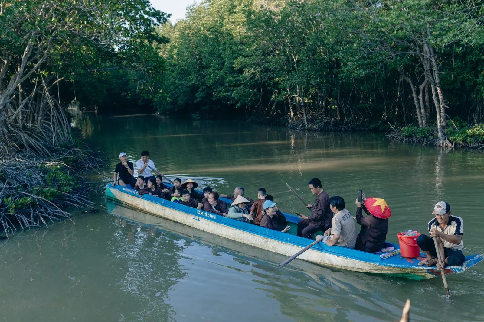
Most of Ca Mau's coastline is covered by mangrove forests (Rhizophora, Avicennia, Sonneratia) — forming a "green barrier" protecting the land. This UNESCO-recognized ecosystem is home to hundreds of marine species.
How Do Ca Mau's Beaches Differ from Central Vietnam's?
| Feature | Ca Mau Coast | Da Nang / Phu Quoc Beaches |
|---|---|---|
| Water color | Murky (rich in sediment) | Turquoise / blue |
| Coastline | Alluvial mudflats + mangrove forests | Long, white sandy beaches |
| Swimming | Limited (Khai Long Beach) | Excellent for swimming |
| Seafood | Extremely abundant, affordable | Abundant, higher prices |
| Ecosystem | Unique mangrove forests | Coral reefs, sandy beaches |
| Best for | Ecological exploration, photography | Relaxation, swimming |
Can You See the Sea from Ca Mau Cape?
This is the most common question from first-time visitors to Ca Mau. The answer is: YES, and very clearly. When standing at the GPS landmark of the southernmost point (coordinates 8°33'N, 104°49'E), you will see:
- To the east: The East Sea — darker blue water, larger waves
- To the west: The Gulf of Thailand — lighter greenish-blue water, smaller waves
- The demarcation line: During the dry season (Jan–Apr), you can sometimes clearly see the distinct line where the two water colors meet
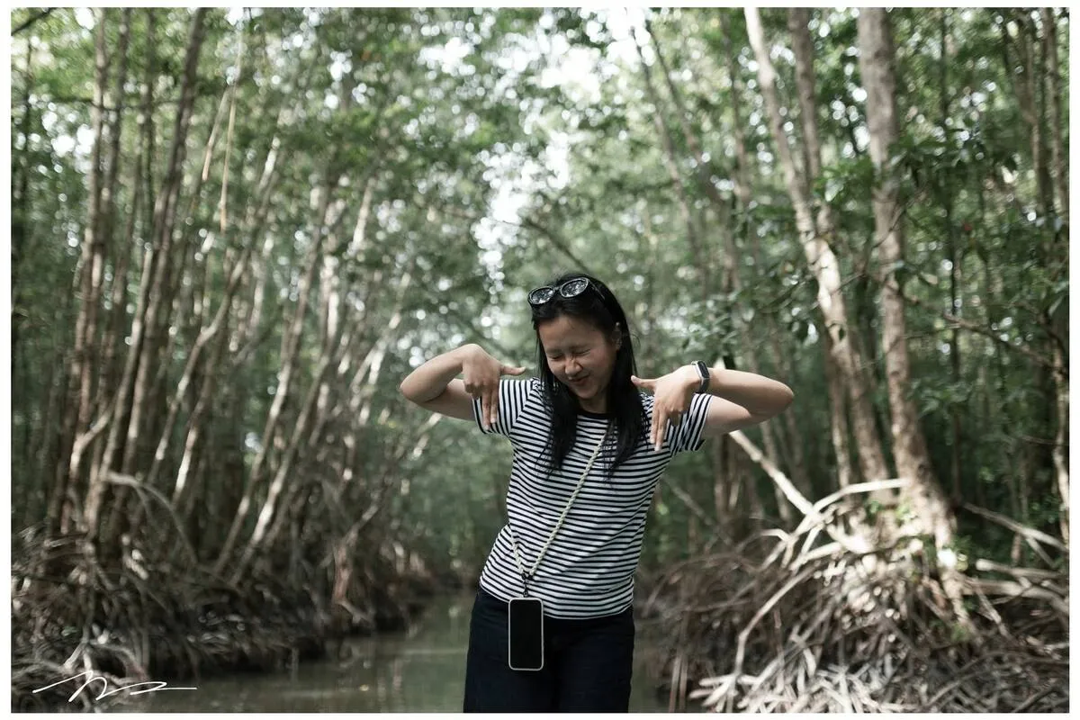
To reach this landmark, you need to take a boat from Nam Can town or from Dat Mui — a journey through the mangrove forest takes about 30–45 minutes. This is the most fascinating part of the Ca Mau Cape tour.
Dat Mui — Vietnam's Most Special "Beach"
Instead of sandy beaches, Dat Mui features alluvial mudflats — new land areas forming daily from the Mekong River's sediment. Each year, Ca Mau "advances into the sea" by 50–100m on the west side and 25–30m on the east side. This accretion rate is the fastest in Southeast Asia.
When you step onto the Dat Mui mudflats, you are standing on the youngest land in Vietnam — land that has "emerged" from the sea only in recent decades. There is no similar experience at any other destination in Vietnam.
When is the Best Time to Visit Ca Mau Cape?
Dry season (November–April): Best for coastal visits and exploring the Cape. Sunny weather, clearer sea water, regular boat operations, and the path to the Cape is not flooded. See more details in the article When is the Best Time to Visit Ca Mau?.
Rainy season (May–October): Still possible to visit but bring a raincoat. On the upside, the mangrove forests are greener, seafood is more abundant, and there are fewer tourists, so tour prices are often 15–20% cheaper.
Frequently Asked Questions
Are Ca Mau's beaches beautiful? Can you swim there?
Ca Mau's coast is completely different from Central Vietnam's — it's an alluvial mudflat and mangrove forest coastline, without long white sands. Some spots like Khai Long Beach (Ngoc Hien district) allow swimming during the dry season, but the water is often murky. The beauty of Ca Mau's coast lies in its unique mangrove ecosystem and surreal mudflats — not in resort-style sandy beaches.
Is there snorkeling or diving in mainland Ca Mau?
There are no snorkeling or diving activities in mainland Ca Mau due to murky water and lack of coral reefs. If you want to snorkel, consider nearby island tours like Con Dao Tour or Nam Du & Hon Son Tour — these spots have clear blue water and beautiful coral.
How long does it take to get to an island from Ca Mau?
Con Dao: fly from Can Tho or Ho Chi Minh City ~1 hour. Nam Du: ferry from Rach Gia ~2.5 hours (Rach Gia is ~120km from Ca Mau). Hon Son: ferry from Rach Gia ~2 hours. It's recommended to combine Ca Mau with one of these destinations into a comprehensive Mekong Delta tour to save on travel.
Should I choose Con Dao or Nam Du for an island tour?
Con Dao is suitable for: revolutionary history, sea turtles, pristine islands, luxury resorts — travel by plane, 3 days 2 nights. Nam Du is suitable for: more affordable blue seas, king crabs, fishing, stunning sunsets — travel by ferry from Rach Gia, 2 days 1 night. Choose Nam Du for a limited budget; choose Con Dao for a special experience.
Discover Ca Mau Cape — Where the East Sea Meets the Gulf of Thailand
Full-day Ca Mau Cape tour: traverse mangrove forests, reach the southernmost landmark, catch mud crabs by the sea, enjoy fresh seafood on the spot.
Related Articles
Island Tour
Con Dao Tour 3D2N — Pristine Island, Sea Turtles, History
Island Tour
Nam Du & Hon Son Tour 2D1N — Blue Sea, King Crab
Discovery
First-Time Visitor's Guide to Ca Mau Cape — Local Tips
Transportation
How to Get from HCMC to Ca Mau? Comparing 4 Options

Written by
Tran Bi (Founder of Ba Ngoai Homestay)
Tran Bi is a local tourism expert with over 10 years of experience guiding visitors through Cape Ca Mau and the U Minh mangrove forests.
Experience Ca Mau Ecotourism Firsthand
Join our local guides to explore the mangrove forests, catch mud crabs, harvest wild honey, and stay at our cozy homestay.