
Conquering the 4 extreme points of Vietnam — North, South, East, West — is a travel dream for many. From the proud Lung Cu flagpole amidst the clouds of Ha Giang, through the A Pa Chai border junction where "a rooster's crow is heard by three countries," to Mui Doi with its waves crashing at the easternmost edge, and the Southernmost point of the Fatherland at Cape Ca Mau — where the land melts into the sea. This article provides comprehensive information on all 4 extreme points, along with suggestions for nearby destinations worth visiting on each journey.
North
Lung Cu
Ha Giang
East
Mui Doi
Khanh Hoa
West
A Pa Chai
Dien Bien
South
Cape Ca Mau
Ca Mau
1. Northernmost Point — Lung Cu, Ha Giang
The Lung Cu Flag Tower is located in Lung Cu commune, Dong Van district, Ha Giang province — the northernmost point of Vietnam's mainland on the summit of Dragon Mountain at an altitude of 1,700m above sea level. The 54m² red flag with a yellow star fluttering in the sky is a sacred symbol of sovereignty, where every Vietnamese who sets foot here cannot help but feel a surge of emotion.
Traveling to Lung Cu usually starts from Hanoi following the route: Hanoi → Ha Giang city (about 4–5 hours by car) → Dong Van (another 3–4 hours via treacherous passes) → Lung Cu (another 30 minutes). The entire one-way journey from Hanoi takes about 8–9 hours, so it is often divided into 2–3 days.
Nearby places worth visiting
- Ma Pi Leng Pass — one of the "four great passes" of Vietnam, with the most majestic scenery
- Dong Van Old Quarter — ancient stone architecture, weekend market every Sunday
- Dong Van Karst Plateau — UNESCO Geopark, unique limestone terrain
- Meo Vac & Nho Que River — kayaking beneath sheer vertical cliffs
Best time to visit: October–November (buckwheat flowers bloom) or March–April (peach blossoms, plum blossoms, cool weather). Avoid the rainy season from June to August due to slippery mountain roads and thick fog.
2. Easternmost Point — Mui Doi, Khanh Hoa

The easternmost point of Vietnam's mainland is Mui Doi, located on the Hon Goc peninsula, Van Thanh commune, Van Ninh district, Khanh Hoa province. This is the first place on mainland Vietnam to welcome the sun every morning — a meaningful detail that makes the sunrise experience here more special than anywhere else in the country.
Unlike the other 3 extreme points, Mui Doi has no road leading all the way there — visitors must take a boat from Dam Mon pier (Van Ninh district) or trek along a coastal trail. This is the interesting feature that makes the Easternmost point the most challenging to conquer among the 4 poles, suitable for those who love wild exploration.
Nearby places worth visiting
- Nha Trang — bustling coastal city, about 60km from Van Ninh, full of resorts and seafood
- Da Lat — city of thousands of flowers, about 130km from Nha Trang via Khanh Le pass, cool climate 18–22°C year-round, ideal to combine in a South Central Coast trip
- Van Phong Bay — one of the most beautiful bays in Southeast Asia, right near Van Ninh
- Diep Son Island — unique walking path amidst the sea, 30 minutes by boat from Van Ninh
Best time to visit: January–August, calm sea, beautiful sunshine. Avoid September–December as this region often has storms and heavy rain.
3. Westernmost Point — A Pa Chai, Dien Bien

The westernmost point of Vietnam is A Pa Chai, located in Sin Thau commune, Muong Nhe district, Dien Bien province. This is the border junction of Vietnam – Laos – China, where folklore says "a rooster's crow can be heard in three countries". Landmark zero is placed at the intersection of the three border lines, creating a unique geographical symbol.
The journey to A Pa Chai is the most challenging of the 4 extreme points: fly or take a vehicle from Hanoi to Dien Bien Phu city (~470km), then continue ~170km on mountainous roads to Muong Nhe, then walk or hire a motorbike taxi to Ta Mieu village for about 5–7km. The entire journey in the rainy season can be cut off due to muddy roads.
Nearby places worth visiting
- Dien Bien Phu City — historical site of the 1954 Dien Bien Phu Campaign, A1 cemetery, De Castries bunker
- Muong Thanh Valley — the largest rice field in the Northwest, most beautiful during the ripe rice season in September–October
- Ha Nhi ethnic village in Sin Thau — unique indigenous culture barely influenced by the outside
- Pa Khoang Lake — beautiful artificial lake 17km from Dien Bien Phu city
Best time to visit: November–April (dry season), the road into the village is not muddy. You need to register for a permit to enter the border area at the Sin Thau Border Guard Post before entering.
4. Southernmost Point — Cape Ca Mau (Dat Mui)
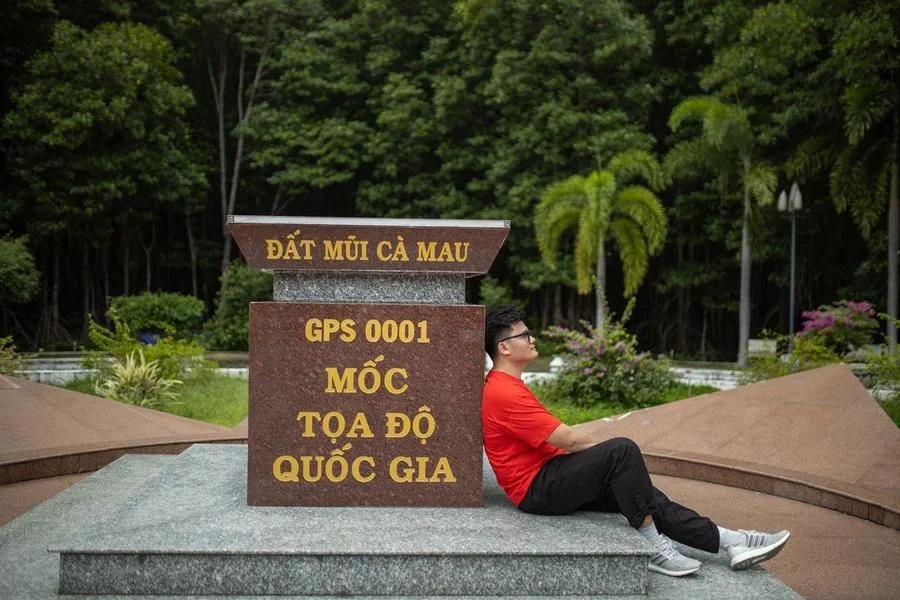
The southernmost point of Vietnam's mainland is Cape Ca Mau, located in Dat Mui commune, Ngoc Hien district, Ca Mau province. The GPS 0001 landmark placed here is the symbol of the final point in the South of the Fatherland. More special than all the other 3 extreme points: this is the only place in Vietnam where you can watch the sun rise from the East Sea and set into the West Sea on the exact same day. See Cape Ca Mau travel experiences to prepare before you depart.
The Cape Ca Mau alluvial plain is expanding every year by 50 to 80 meters thanks to alluvium deposited by the Mekong River — meaning the country is still growing day by day at this southernmost tip. The entire area is surrounded by Cape Ca Mau National Park (total area of 41,862 hectares), recognized by UNESCO as a World Biosphere Reserve in 2009 and as the 2088th Ramsar site in the world (2012).
Journey to Cape Ca Mau (from HCMC)
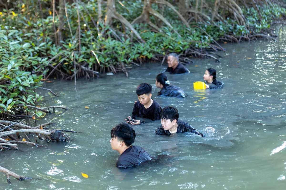
The experience at Cape Ca Mau does not stop at checking in the landmark. The canoe journey through the primary mangrove forest, admiring the mudflats expanding into the sea, and enjoying specialty seafood of Ca Mau right at Dat Mui — these are memories that cannot be found at any other extreme point in the country.
Nearby places worth combining — Southern Seas & Islands
- 🏝️ Nam Du (Kien Giang) — an archipelago of 21 pristine islands, crystal clear seawater, scuba diving. From Rach Gia it takes about 2.5–3 hours by high-speed boat. View Nam Du tour by Bà Ngoại Homestay →
- 🏝️ Hon Son (Kien Giang) — island still pristine, fewer tourists, famous Bang beach with turquoise water. On the same boat route as Nam Du from Rach Gia.
- 🏝️ Con Dao (Ba Ria – Vung Tau) — paradise island with some of the most beautiful beaches in Vietnam, sea turtle conservation area, moving Con Dao prison history. Flight from HCMC or Can Tho takes only 45–50 minutes. View Con Dao tour by Bà Ngoại Homestay →
An ideal itinerary for the "Southernmost region": Ca Mau 2–3 days (Cape Ca Mau + U Minh Ha) → Nam Du or Hon Son for 2 days (from Rach Gia) → Con Dao for 2–3 days (fly from HCMC or Can Tho). This entire southern route can be wrapped up in 7–10 days. Also refer to how to travel from HCMC to Ca Mau to save time and costs.
5. Comparing the 4 Extremes: Where Should You Go First?
| Criteria | North | East | West | South |
|---|---|---|---|---|
| Accessibility | ⭐⭐⭐ | ⭐⭐⭐⭐ | ⭐⭐⭐⭐⭐ | ⭐⭐ |
| Natural scenery | ⭐⭐⭐⭐⭐ | ⭐⭐⭐⭐ | ⭐⭐⭐⭐ | ⭐⭐⭐⭐⭐ |
| Special experiences | Ma Pi Leng Pass | Sunrise at East Pole | Border junction | Mangrove forest + 2 seas |
| Combining with islands | No | Diep Son | No | Nam Du, Hon Son, Con Dao |
| Suitable for | Backpacking, trekking | Exploration, wilderness | Hardcore backpacking | Everyone |
6. Suggested Itinerary for Conquering the Four Extremes
It is not necessary to visit all 4 extremes in one trip. The most common way is to divide them into 4 trips across 4 seasons in a year, each trip combining the extreme point with nearby attractions:
–Nov
North — Ha Giang
Lung Cu + Dong Van + Meo Vac + Ma Pi Leng pass. Buckwheat flower blooming season. 5–7 days from Hanoi.
–Mar
East — Khanh Hoa + Da Lat
Mui Doi + Nha Trang + Da Lat. Calm sea, beautiful sunshine, Da Lat blooming. 7–10 days from HCMC or Hanoi.
–Apr
West — Dien Bien
A Pa Chai + Dien Bien Phu City + Muong Thanh valley. Dry season, favorable road to the village. 5–7 days from Hanoi.
–Apr
South — Ca Mau + Islands
Cape Ca Mau + U Minh Ha + Nam Du or Hon Son + Con Dao. Dry season, the most beautiful and calm seas. 7–10 days from HCMC.
7. Frequently Asked Questions
What are the exact locations of the 4 extremes of Vietnam?
North: Lung Cu commune, Dong Van district, Ha Giang province. South: Dat Mui commune, Ngoc Hien district, Ca Mau province. West: Sin Thau commune, Muong Nhe district, Dien Bien province. East: Mui Doi, Hon Goc peninsula, Van Thanh commune, Van Ninh district, Khanh Hoa province.
How much does it cost to travel to the 4 extremes?
Each extreme point has a different cost. The South (Ca Mau) is easy to access and has package tours from 890,000 VND/guest. The North (Ha Giang) by rented motorbike costs about 1,500,000–2,500,000 VND/person/5 days. The West (A Pa Chai) is the most expensive due to its remote terrain, estimated at 3,000,000–5,000,000 VND/person. The East (Mui Doi) requires renting a private boat, about 500,000–1,000,000 VND/boat.
Which extreme is the easiest for those not used to backpacking?
The South (Cape Ca Mau) is the easiest — there are package tours, stable roads, and no need for mountain climbing or trekking skills. Suitable for families, children, and the elderly. The West (A Pa Chai) is the most difficult, demanding good health and jungle trekking experience.
Can you travel to Nam Du and Con Dao from Ca Mau?
Nam Du and Hon Son depart from Rach Gia (Kien Giang), about 130km from Ca Mau City. Flights to Con Dao are available from HCMC or Can Tho. All 3 destinations can be combined in a 10-day southern journey. Bà Ngoại Homestay has tours to Nam Du + Hon Son and Con Dao, contact us for consultation.
References
To ensure absolutely accurate geographical data and coordinates, the information in this article is referenced from the following official data sources:
- Department of Surveying, Mapping and Geographic Information of Vietnam (Ministry of Natural Resources and Environment): Published data on national standard coordinates of extreme points on the mainland.
- The Land Border Treaty between the Socialist Republic of Vietnam and the People's Republic of China (signed in 1999) determining the location of the Northernmost landmark (Lung Cu) and the Westernmost (A Pa Chai).
- National Boundary Commission - Ministry of Foreign Affairs of Vietnam: Documentation verifying the geographical-administrative extreme points of Vietnam's territory.
- Cape Ca Mau National Park Management Board & Nature Reserve Management Board: Administrative data on the area of the southernmost sovereignty landmark.
Start From The South — Cape Ca Mau!
The Southernmost point is the easiest, most beautiful, and most experience-rich destination. Contact Mr. Bi to book tours to Cape Ca Mau, Nam Du, Hon Son, or Con Dao today!
Related Articles


Article Author
Trần Bì (Founder of Bà Ngoại Homestay)
Mr. Tran Bi is an expert in culture, history, and indigenous eco-tourism in Ca Mau with over 10 years of experience guiding guests to experience U Minh Ha forest and Dat Mui.
Authentic Ca Mau Travel Experience
Join Uncle Ba Khia to explore Dat Mui, traverse mangrove forests, catch crabs, collect honey, and stay at Mr. Bi's cool eco-homestay.